Pennsylvania Coastal Resiliency

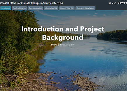
PA Coastal Resiliency Story Map

New resource! This story map shows current and future flood scenarios in the PA DECZ, as well as potential impacts to property value and critical municipal facilities. Information on the benefits that municipalities and property owners may receive by participating in the Community Rating System, a voluntary national program incentivizing flood prevention while reducing flood insurance premiums for property owners, is also included.

Coastal Effects of Climate Change in Southeastern PA Story Map
View current and future flood scenarios along the tidal Delaware River in Pennsylvania, as well as potential impacts to property value and critical municipal facilities.

Increases in temperature associated with climate change are predicted to cause higher sea levels and more frequent heavy storms, both of which will introduce new degrees of flooding vulnerability that communities will need to address. This page serves as a resource for municipalities, especially those along or near the Delaware River in Pennsylvania, who are are looking for information to help them plan for floods.

This webpage stems from work that began in January 2018. DVRPC staff met with municipal leaders and staff in the Delaware Estuary Coastal Zone (DECZ) to talk about their experiences with past flood hazards and concerns about future floods. At these meetings, DVRPC staff shared a poster that included an introduction to current and future flooding issues along the Delaware River and other connected tidal waterways, estimates of future flood heights using historic tide gauge data, a list of the most significant flooding issues facing municipalities in the DECZ, strategies that municipalities could take to address flooding issues, and sources of funding and technical assistance that could help them take action.

The following information in this webpage is an expansion of the information provided in the poster. It also serves as a general resource for communities, especially those located on or near tidal waterways that are working to address flooding from sea level rise, storm surge, stormwater runoff, and/or riverine flooding (floods coming from rivers rather than from the coast or tidal waterways).


Flood Resilience in the Pennsylvania Delaware Estuary Coastal Zone (DECZ)

Increases in temperature associated with climate change are predicted to cause higher sea levels and more frequent heavy storms, both of which will introduce new degrees of flooding vulnerability that communities will need to address. This page serves as a resource for municipalities, especially those along or near the Delaware River in Pennsylvania, who are looking for information to help them plan for floods.

Bristol Township SLR Assets
Future coastal flood height scenarios and FEMA 1% chance floodplain in Bristol Township
(click to view informational posters with maps for select DECZ municipalities). [1.2 MB pdf]

Flooding Problems for Municipalities in the DECZ

In the fall of 2017, DVRPC sent a survey to staff from DECZ municipalities to learn about historic flooding issues in these municipalities, steps they have taken to address these issues, and their concerns regarding future floods. Thirteen municipalities responded out of a total 29 that were contacted (44.8 percent). The main concerns of respondents fit into the following categories:

  1. Flooding of private property (homes, cars, commercial buildings)

    • Especially residential basements

  2. Flooding of roadways

  3. Stress on aging flood mitigation and stormwater infrastructure (sewer lines, storm drains, inlets, dikes, levees)

  4. Secondary effects of flooding: siltation, erosion, pollution

  5. Destruction of tidal wetland habitat

  6. Insufficient flood monitoring systems

The responses of these DECZ municipalities form the basis for the resources shared in this webpage, but these resources are also intended for municipalities outside of the DECZ who grapple with flooding problems.

Flood Analysis

DVRPC staff modeled flood height scenarios at three feet, five feet, seven feet, nine feet, and eleven feet above mean higher high water, which is an average of recordings of the highest daily high tide value on a given tide gauge. These mean higher high water values were referenced to the North American Vertical Datum of 1988 (NAVD88). NAVD88 is a standard surface, essentially of zero feet in height, that is used on the North American continent to consistently measure and compare elevations above that height. All measurements using NAVD88 are based on a particular tide gauge in Quebec, Canada. Flood elevations are one example of a variable that relies on NAVD88. More information on mean higher high water, NAVD88, and other datums is located on NOAA's “Vertical Datums” webpage.

The five flood depth scenarios modeled for this project - three feet, five feet, seven feet, nine feet, and eleven feet - either have already occurred along the Delaware River or could occur in future conditions with permanent sea level rise and/or strong storms.

What Can Municipalities Do About Flooding?

The majority of the recommendations and resources are derived from two sources:

  • Getting to Resilience reports written in 2015 by the Jacques Cousteau National Estuarine Research Reserve (JCNERR). JCNERR wrote these reports for municipalities that completed the Getting to Resilience questionnaire, which is a set of questions posed to municipalities about their past and ongoing work to plan for and respond to coastal flood hazards. The reports offer recommendations based on the municipality’s responses to the questionnaire. DVRPC used information from these reports in another project, the New Jersey Resilient Coastal Communities Initiative, which was administered by the Office of Coastal and Land Use Planning in the New Jersey Department of Environmental Planning (NJDEP), and which was funded by the National Oceanic and Atmospheric Administration (NOAA).
  • Chester City’s Climate Adaptation Planning Element in its Vision 2020 Master Plan, which DVRPC co-authored in 2014 with the project leaders, Pennsylvania Sea Grant, and the rest of the Chester Hazards and Climate Adaptation Project Team.

How Can This Work Be Funded?

Although finding funding for community resiliency projects can be challenging, many government and private sector organizations are increasingly focusing their resources on helping communities to better prepare for and adapt to a changing climate and future floods.

The resource list below is not exhaustive, but rather represents a selection of funding and programs available at the time of publication (December 2017). The Pennsylvania Silver Jackets Interagency Flood Mitigation Program Guide, which was updated in October 2015, also provides information on federal, state, and local programs available to assist municipalities with flood mitigation activities.

More information on a wide variety of financial assitance can be found through DVRPC's Municipal Resource Guide.