The Greenspace Network is an inter-connected system of naturally-vegetated open space linking existing parkland, population centers and key natural resource areas at the regional scale. Linking "green spaces" throughout the region boosts their ecological, recreational scenic and economic value. Greenspace is a form of public infrastructure necessary for community health, function and sustainability.
The Greenspace Network is based on the principles of protecting core natural open space areas and linking them with continuous greenways. The Network proposes to protect large expanses of unprotected woodlands, stream corridors, wetlands, meadows, vacant lands-and, in some cases, protect and restore agricultural lands to a natural state-and join them with existing parks to create an inter-connected system. Most Pennsylvania Natural Diversity Index (PNDI) sites are included within the Network, as are New Jersey's Natural Heritage Priority Sites. The Greenspace Network also includes nearly all significant natural areas proposed for protection by county open space and greenway plans.
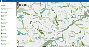
The Greenspace Network enhances ecological and recreational capacity, protects critical natural resources, ameliorates the impacts of sprawl, and improves the quality of life in the region's communities. Each of the 104 greenspace corridors in the Network is named to promote its identity and brand it as a unique preservation project.
Given the regional scale of the map, the proposed network is somewhat generalized, but it serves to create a framework for state, county and municipal preservation plans. More detailed mapping at the local area scale is recommended to determine specific boundaries and priorities. The proposed Greenspace Network is aimed at achieving the following specific objectives:
- The protection of woodlands and other upland habitat areas that provide an environment for the diverse plants and animals of the region, particularly those areas identified as containing threatened and endangered species.
- The protection of river and stream corridors, floodplains, and wetland areas that provide clean water for drinking, habitat for fish, plants and other wildlife, and recreational opportunities. Vegetated buffers varying from 25 to 300 or more feet are recommended to improve and maintain water quality, control stream temperatures, reduce streambank erosion, filter non-point source runoff, and provide habitat. In some instances, buffer areas may also accommodate recreational trails or public access for fishing, boating and other recreational uses.
- The protection of other unique natural resource features including notable ecosystems, geologic formations, or habitat areas containing unique, threatened or endangered species.
- Providing lands for the construction of trails and paths that connect and provide access to parks, streams, woodlands and population centers. This system of trails and greenways can provide access to a variety of different but connected resource areas. It should be noted that some ecologically-sensitive resource areas may not be appropriate for all forms of recreational use.
- Finally, open space in the region provides valuable visual and sensory relief from the man-made environment and connects people to the natural world. In many ways, it is the ongoing presence of a stream valley, wooded hillside or patch of forest that acts as an identifier of home, or is a key ingredient in creating a "sense of place".